 Chinese
 German
 Spanish
 Japanese
 Korean

Mobile mapping systems have become an increasingly common part of infrastructure and construction projects. The systems save time and money, while improving workflows and maintaining accuracy.
In this blog, we’ll give you a primer on how mobile mapping in infrastructure and construction is enabling faster and more efficient project delivery. We’ll cover how mobile mapping works, its role in construction, the benefits and challenges, plus some real-world applications and case studies.
Why mobile mapping is gaining momentum: The shift to digital-first infrastructure
The rise of mobile mapping is due to a confluence of factors. A major factor is that clients expect higher standards and faster delivery than ever before. Thankfully, mapping hardware is getting more sophisticated and less expensive, while software is getting faster and more advanced, enabling construction and infrastructure firms to meet those client demands.
The result is that the construction and infrastructure industries are becoming increasingly, and in some cases predominantly, a digital sector. Engineers use surveys, IoT sensors and Building Information Modelling (BIM) for planning, safety monitoring, performance simulation, and project optimisation. They build real-time digital twins of physical structures. After construction, they use sensors to monitor everything from light bulbs and temperature to air quality and parking patterns to enable predictive maintenance schedules.
What is mobile mapping?
If you’re new to mobile mapping, read our Beginner’s Guide. In essence, mobile mapping systems in construction combine a survey dataset such as a LiDAR point cloud with geospatial data, gathered from a moving platform. The resulting datasets can then be used for measurements, and fed into CAD and BIM workflows.
Core technologies (LiDAR, cameras, GNSS, IMU, INS)
Central to the mobile mapping system are the sensors used to gather the various types of data needed. These tend to be the localisation or positioning device, and an array of perception sensors. Typically, mobile mapping vehicles contain:
- Camera, LiDAR, Radar to conduct the survey
LiDAR (Light Detection and Ranging) has increased in popularity for mobile mapping in infrastructure and construction. It uses beams of light to measure the distance between the sensor and objects on the site or building. The sensor creates millions of data points, which when georeferenced with position, orientation and timing data from a localisation solution forms a “point cloud” that can be used for incredibly precise measurements.
- GNSS/INS for localisation
A GNSS/INS combines position data from Global Navigation Satellite Systems (GNSS) with data from an inertial measurement unit (IMU) to estimate position, heading, and orientation.
Learn more: What is an inertial navigation system?
GNSS/INS is one of the most common technologies for localisation, although Visual SLAM, LiDAR SLAM, and wheel odometry are also common, especially in indoor and mobile robot-based mapping.
Emerging technologies: multi-sensor fusion platform for seamless position accuracy
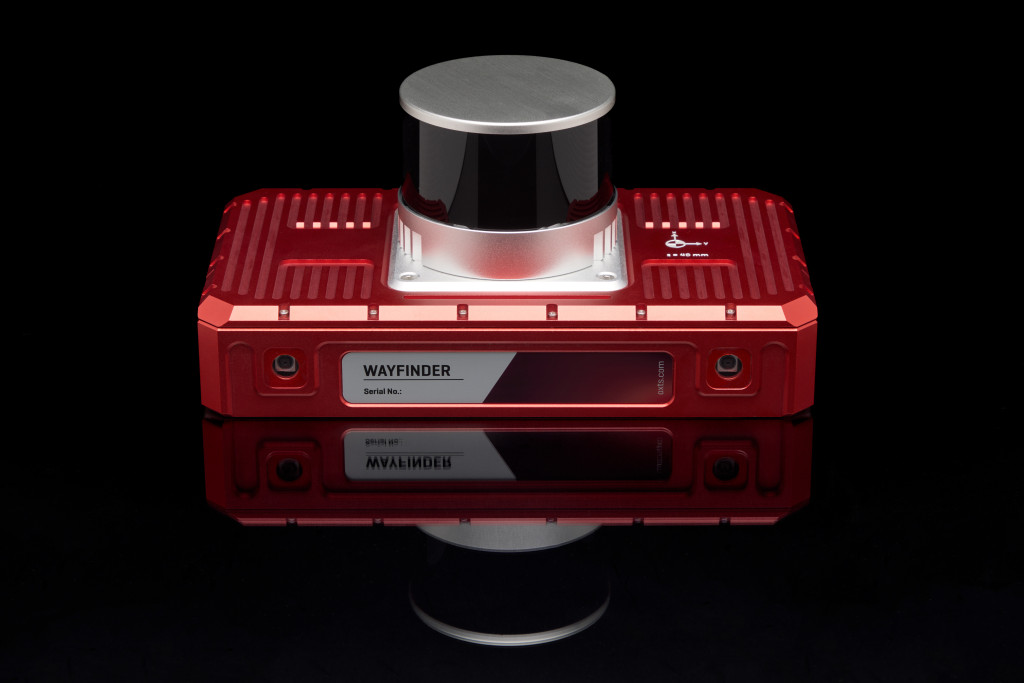
When your GNSS signal drops – for instance if you move indoors or through tunnels – you need to compensate for missing or inaccurate data. Wayfinder, a real-time sensor fusion platform by OXTS, provides accurate position data in any environment – even when moving between indoor and outdoor spaces – by switching seamlessly between localisation methods.
Multi-sensor fusion is arguably the most exciting area of development in mobile mapping, as it enables surveyors to get more accurate data from a wider range of environments, greatly increasing the value of the survey data for construction and infrastructure firms.

Platforms: Vehicles, UAVs, Robots, Backpacks
There are multiple methods of carrying mobile mapping systems. Some of the more common include:
- Vehicles: Vans or cars loaded with cameras and LiDAR sensors ready to cover a wide area.
- UAVs: Perfect for aerial surveys of areas too big or inaccessible for vehicles.
- Robots: Often used if the space is too tight for driving or flying, or too dangerous for humans.
- Backpacks: Useful for pedestrian-only or indoor areas.

The key benefits of mobile mapping for infrastructure and construction
Compared to traditional static surveying, enables an engineer to gather more data, more quickly, and at a lower cost. Key benefits include:
1. Richer datasets for BIM and digital twins
LiDAR surveys produce millions or even billions of data points, in turn allowing you as an infrastructure and construction professional to build rich, detailed and highly accurate models.
2. Faster data collection over large areas
Research published by the Royal Institution of Chartered Surveyors (RICS) in 2020 showed that mobile mapping is 2 to 3 times faster than traditional surveying. That can greatly speed up projects and keep clients happy.
3. Fewer site visits and fewer mistakes
Faster surveys mean less time on site, reducing surveying costs. LiDAR surveys especially mean you don’t need to do measurements on site – you can take measurements from the data. So, the chance of needing to re-visit a site because you missed a measurement plummet.
4. Reduced cost and labour requirements
As well as taking less time, Mobile Mapping requires fewer people than a typical traditional survey. In contrast, the less arduous setup requirements mean a typical mobile mapping survey can often be managed by one or two people.
5. Improved safety
Fewer people on site, for less time, means less crowded building sites and minimises on-road exposure, reducing the risk of injury.
Real-world applications transforming the industry
You may already have seen mobile mapping technology in action, and seen how much it’s changing the game. Let’s look at some of the most common real-world applications:
1. Road and highway mapping
Map a road by simply driving along it. This is much faster than traditional surveys, vastly improves predictive maintenance, and provides valuable data for navigation apps. It’s also much safer for the workforce, as there’s no need to stand by the roadside.
Using technology provided by OXTS, for instance, Panpro Team has surveyed more than 200km of roads in Europe this way.
2. Rail corridor assessment
Rail corridors are challenging for surveyors, with trees canopies and tunnels blocking GNSS signal and aerial surveys. They also present significant safety risks for the surveyors venturing near the tracks to work. But with sensor fusion, combining inertial data with SLAM and other aids, you can map all these environments – even where GNSS signal would normally be blocked – without anyone having to walk along the tracks. We’ve even seen pilot projects where survey payloads are mounted to the trains themselves to provide continuous mapping of rail networks.
3. Bridge and tunnel inspection
Bridges and tunnels are not only difficult to survey but often dangerous. Using drones with a mobile mapping set up can be much safer for workers as well as being much faster. The Michigan Department of Transportation found that UAV inspections with a drone took just one quarter of the time of traditional methods.
4. Utility and asset management
Using high-precision GNSS and LiDAR to provide accurate 3D maps of utility infrastructure such as fibre cables, or a power plant, can support installation, maintenance and repair, with more efficiency and lower cost, not to mention greater safety as fewer personnel are required to go into live traffic or hazardous environments.
5. Construction progress tracking
At each stage of the construction process, Mobile Mapping makes it quicker and easier to get an accurate picture of your progress:
- At the pre-design stage, mobile mapping makes it easier to conduct feasibility studies by capturing existing geology, clearances and corridor constraints in a single dataset, providing survey-grade reality data before design assumptions are locked in.
- For design and engineering, mobile mapping provides detailed, georeferenced 3D data to help you identify issues and reduce your reliance on assumptions.
- During construction, mobile mapping enables periodic scans for monitoring and verification, highlighting any deviations from the design.
- At completion, mobile mapping captures the finished condition of the site for accurate as-built records, compliance, handover documents, and even the creation of a digital twin for ongoing building management. A digital twin of the Notre Dame cathedral was vital in the reconstruction efforts, providing a precise blueprint for restoration.
Case examples: mobile mapping success in infrastructure projects
OXTS is proud to have been part of several successful mobile mapping projects in the construction and infrastructure space.
One example is BeeXact. BeeXact is the leading global service provider for 360-degree geospatial data, engineering, asset management and fibre network designs. When BeeXact was contracted to collect position and identification information for Italy’s fibre optic infrastructure using LiDAR, they had to survey Italy’s entire road network, a near impossible task with traditional methods.
Instead, they used LiDAR in combination with a custom data processing pipeline developed with OXTS, using NAVsolve CMD to automate the application of nationwide GNSS corrections from Leica’s Smartnet RINEX service. This gave them vast and consistent levels of data and is being used as a template for similar projects in other countries.
Read the full story: BeeXact
When it comes to the most complex sites, this technology is indispensable. When Dronezone SRL needed to map an old railway bridge, they used a Velodyne VLP-16 LiDAR sensor combined with a DZX8 Heavy Drone, and the xNAV650 from OXTS for localisation, meeting SWaP-C requirements while remaining accurate enough to produce a 3D point cloud. Crucially, they also used OXTS Georeferencer, with boresight calibration capable of calibrating the coordinate frames of the xNAV650 and Velodyne VLP-16 sensor, removing any blurring or double vision from the final result.
Read the full story: Dronezone SRL
New applications are being developed all the time. When Panpro Team set out to develop a new arm of its business, providing traffic authorities with data about the distance drivers can see ahead or behind them on notoriously dangerous stretches of road networks. To do so, engineers combined an OXTS xNAV650 GNSS/INS for georeferencing, an Ouster OS2 LiDAR, and the OXTS Georeferencer application. The OXTS boresight calibration tool vastly reduced any blurring or double vision, producing accurate results that helped Panpro acquire clients in two EU countries.
Read the full story: Panpro Team
Challenges and considerations when deploying mobile mapping
The advantages of mobile mapping are real, but that doesn’t mean there are no challenges to using it. In GNSS-denied environments, for example, mapping becomes very difficult unless you have the right combination of additional sensors. Weight can also be a hurdle when using drones or robots with limited battery life, so make sure you look for the right low-SWaP payload. Ensure your data processing tools integrate with your BIM as well.
One of the most common issues that engineers and surveyors overlook is calibration and sensor alignment. Any slight misalignment between a GNSS/INS and LiDAR can make your point cloud blurry and possibly unusable. The OXTS Boresight Calibration Tool solves this problem by taking navigation data from your INS and using it to quickly georeference raw LiDAR data.
This makes the process of aligning coordinate frames much faster. As a result, the final point cloud you produce in OXTS Georeferencer has greater clarity and no double-vision (objects appearing twice in the point cloud).
The future of mobile mapping in construction
As Mobile Mapping technology gets more advanced, 3D mapping for engineers and the construction industry is likely to get faster and more accurate.
How?
Self-driving vehicles and autonomous UAVs have the potential to reduce the need to be on site even further. AI and machine learning can identify and classify features directly from point clouds and images, which could dramatically reduce the manual drafting burden.
VR and AR, meanwhile, mean that you can make and review decisions much more quickly as plans and drawings get replaced by highly realistic 3D representations, in digital and real environments.
Digital twins and smart infrastructure, finally, mean that IoT devices and sensors can support predictive maintenance and asset management with ever-increasing accuracy.
Just as with mobile mapping, this requires a solution that combines GNSS, IMU and LiDAR seamlessly to provide reliable and accurate data in any environment, even when GNSS signal is blocked.
Mobile mapping as a catalyst for faster, smarter infrastructure delivery
Mobile Mapping allows you to conduct surveys on sites, even the most complex ones, more quickly and more easily than you could ever hope for from traditional methods, all while maintaining the necessary levels of accuracy.
Technology, and not just Mobile Mapping, is reshaping where and how you spend your time and it’s changing expectations around how quickly reliable reality data can move into design and construction workflows. As projects become more data-driven and as BIM, digital twins and asset management platforms mature, the value of rich, repeatable 3D capture only increases.
For surveyors and engineers, that means better control of risk, fewer site revisits, and faster access to trustworthy geometry for design and verification. For stakeholders across the board, that means ambition doesn’t come with the same price tag and risk profile that it once did.
Ready to find out more? Whether you’re looking at road mapping, using UAVs, or just curious about how mobile mapping could support you and your team, OXTS is here to help you build something great. Explore the OXTS range of surveying and mapping solutions today.
Download the WayFinder Datasheet
Learn more about the specifications you can expect from the WayFinder sensor fusion system.


