 Chinese
 German
 Spanish
 Japanese
 Korean

Mobile mapping offers faster, more cost-effective geospatial data facilitation, especially in environments where traditional surveying struggles to deliver. This blog examines the differences between traditional surveying practices and mobile mapping, and the use cases for each in surveying.
Traditional Surveying vs Mobile Mapping
What is traditional surveying?
Traditional surveying refers to any survey carried out from static locations including total stations, laser levels, and tripod-mounted LiDAR. These technologies have been in use for decades and are well-established in the surveying community.
What is mobile mapping?
In contrast to traditional surveying, mobile mapping is carried out from a moving vehicle. This can be a land-based vehicle such as a car, or an aerial vehicle such as a drone or a light aircraft.
Generally, the most popular sensor for mobile mapping surveys is LiDAR. But mobile mapping surveys can be done with radar, photogrammetry, or even hyperspectral imaging.
Benefits of traditional surveying
Traditional surveying practices offer the following benefits:
1. High precision (at the cost of mobility)
Traditional surveying methods are conducted using stationary sensors, and gather highly precise data. However, that precision comes at the cost of flexibility – in order to move around a site, the sensors must be physically picked up and moved around.
2. Ease of deployment
Surveyors may already own traditional surveying equipment and be experienced with the accompanying software, making it a simple choice to deploy. However, the growing demand for geospatial data in challenging locations mean this choice could leave surveyors with gaps in their data.

Benefits of Mobile Mapping
Mobile mapping primarily offers greater flexibility, to survey in spaces that traditional surveying cannot.
1. Flexibility
Mobile mapping payloads capture a site more efficiently than surveying from fixed points. In many mobile LiDAR surveying setups, a 360-degree LiDAR makes the capture even simpler by eliminating the risk of blind spots in your survey data during post processing.
2. Distance covered
Mobile mapping is suited to surveying large areas such as rail corridors, road networks, and landscapes. Car mounted and aerial surveying allow you to cover distances much larger than traditional surveyors on foot can achieve. Using drones or UAVs can also open up previously inaccessible areas like cliff faces and off-road areas.
3. Safety
Mobile mapping enables surveyors to capture a site remotely by piloting a drone, or to be safely within a car instead of by a roadside, reducing the risk of injury.
4. Speed
Mobile mapping captures large areas faster than traditional surveying methods, reducing survey time and expense.
5. Performance without GNSS
Mobile mapping platforms compensate for poor GNSS signal in areas such as urban canyons, or when completely indoors, ensuring reliable data capture where total stations or fixed LiDAR scanners cannot.

Key differences; traditional surveying vs mobile mapping
Data collection speed
Traditional survey data gathering, methods are relatively slow compared to mobile mapping, even when using LiDAR. Mobile mapping payloads gather data constantly while moving through the site, while traditional surveying methods involve gathering data at a specific point, moving, resetting, and gathering more data.
Accuracy and precision
Fixed, traditional surveying tools offer greater precision than mobile mapping setups. Mobile mapping solutions function in areas where traditional surveying cannot, giving mobile mapping setups greater accuracy.
Coverage and scalability
Mobile mapping covers far larger areas than traditional surveying, and scales better.
How to choose the right approach for your project
If you need extremely high precision, aren’t surveying a very large area, and don’t anticipate any issues with GNSS, choose traditional surveying.
If you need to survey a large area, or an area where GNSS signal is unreliable, and you have a system that provides the required level of accuracy for your use case, then choose mobile mapping.
BeeXact: a mobile mapping case study
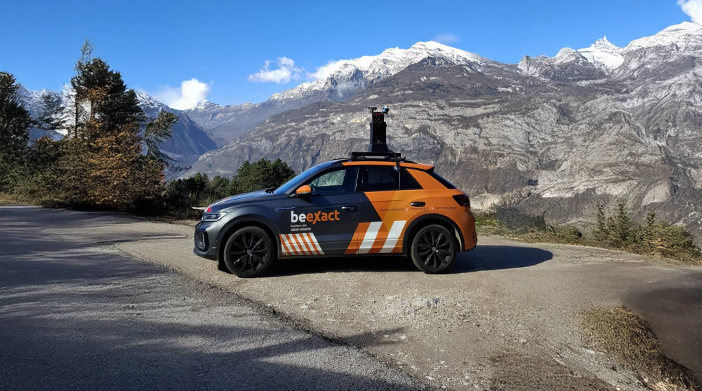
Infrastructure mapping company BeeXact won a contract to map the entirety of Italy’s fibre optic network – something that would clearly be impossible with traditional surveying techniques. To deliver the project, BeeXact turned to mobile mapping – specifically, road-based mapping, and asked OXTS to help design the survey payload.
The RT3000 v4 sits at the centre of BeeXact’s fleet of more than 80 mapping vehicles, with a custom-built data processing workflow that turns the vast quantities of LiDAR data into usable insights for BeeXact’s client.
Mobile mapping vs traditional surveying; what does the future look like?
Industry commentary indicates that in the future, surveying is likely to become increasingly automated, and focus on providing real-time data. Real-time data facilitates instant decision-making for time-sensitive applications (such as comparing as-built construction plans and accounting for any variances). Automation will allow surveyors to work faster and cover more ground, without compromising the quality of the final output.
Both mobile mapping and traditional surveying necessitate an even greater reliance on navigation-grade positioning technology. Real-time survey data needs to be accurate enough to use with minimal, or no, post-processing, and automated surveying equipment needs localisation for the navigation stack that enables the platform to move autonomously.
OXTS GNSS/INS units are already used in these applications.
- Our xNAV650, is popular with surveyors thanks to its accuracy levels and ability to be mounted to cars, planes, or even drones.
- The xRED has been integrated into autonomous mobile robots to provide navigation capabilities.
- The WayFinder family of products is able to perform real-time computations that would facilitate real-time surveying data.
Download the RT3000 v4 Datasheet
Learn more about our flagship mobile mapping GNSS/INS the RT3000 v4


