 Chinese
 German
 Spanish
 Japanese
 Korean

3 reasons to choose an OXTS INS for mobile mapping now
With the importance and value of survey data continuing to rise, it’s important to ensure that the quality is as high a standard as possible. Whether you’re using land-based vehicles or aerial surveying equipment for mobile mapping the challenge at the highest level remains the same; how do you get precision positioning data, for as long as possible during your mission.
In this blog, we’re discussing why having a high-quality GNSS-aided inertial navigation system (GNSS/INS) is vital for mobile mapping – grouping our thoughts into three reasons to choose an OXTS INS for mobile mapping (with a bonus reason for the aerial mappers reading). This blog assumes that you already know what a GNSS/INS is; if you don’t, click below to get caught up:
Read more: Inertial Navigation Systems – why are they essential for mobile mapping with LiDAR?
Reason 1: Accuracy
It can be easy to think of localisation as a hygiene factor in your surveying payload: vital, but ultimately a box ticking exercise. But your OXTS INS for mobile mapping solution can actually be a point of differentiation as a mobile mapper, because the better your GNSS/INS is, the more accurate your survey data is.
A basic GNSS/INS can provide accuracy to within perhaps tens of centimetres – maybe half a metre if you’re using an IMU without GNSS. But an OXTS INS for mobile mapping can provide accuracy down to the centimetre – meaning your survey data can be more accurate. Especially if you are in a field where precision matters, the ability to offer greater accuracy could be a crucial differentiator for your business.
Reason 2: Reliability
The last thing you want to find after a survey is that there’s been an error with the data and you need to go out to survey again. That’s always a risk with low-grade localisation sensors. A momentary dip in coverage (such as driving under trees or a tunnel), a calibration issue, or something else could undo an entire day’s work.
OXTS GNSS/INS technology provides you with reliability in a few ways. Firstly, we’ve perfected the data processing algorithms in our devices to protect position accuracy for as long as possible, and to restore RTK lock (the most accurate real-time signal) sooner after losing coverage completely, such as when you go through a tunnel.
Learn more: gx/ix™ tight-coupling processing
Secondly, we’ve been developing new technologies to preserve accuracy in challenging environments using additional sensors integrated into the GNSS/INS. Our latest product, WayFinder, can navigate from open-sky conditions, through trees, into underground car parks and back again while providing a seamless flow of accurate data.
Finally, OXTS devices have been designed to be as simple to initialise, configure, and operate as possible. Even novice engineers should be able to set up the system, validate that it is performing correctly, and begin gathering data with ease, reducing the risk of configuration errors ruining a day’s work.

Reason 3: Integration potential
Nearly every mobile mapping activity these days is done using some manner of sensor – even photographic surveying is done using a digital camera. A large part of the job, therefore, lies in integrating those sensors with your localisation data to georeference the data.
For any direct georeferencing method (where the localisation data is collected in real time alongside the survey data) the key is clock synchronisation. If you can synchronise the clocks in the sensors and your localisation payload, you can match up the survey data with the geospatial data to create the georeferenced survey.
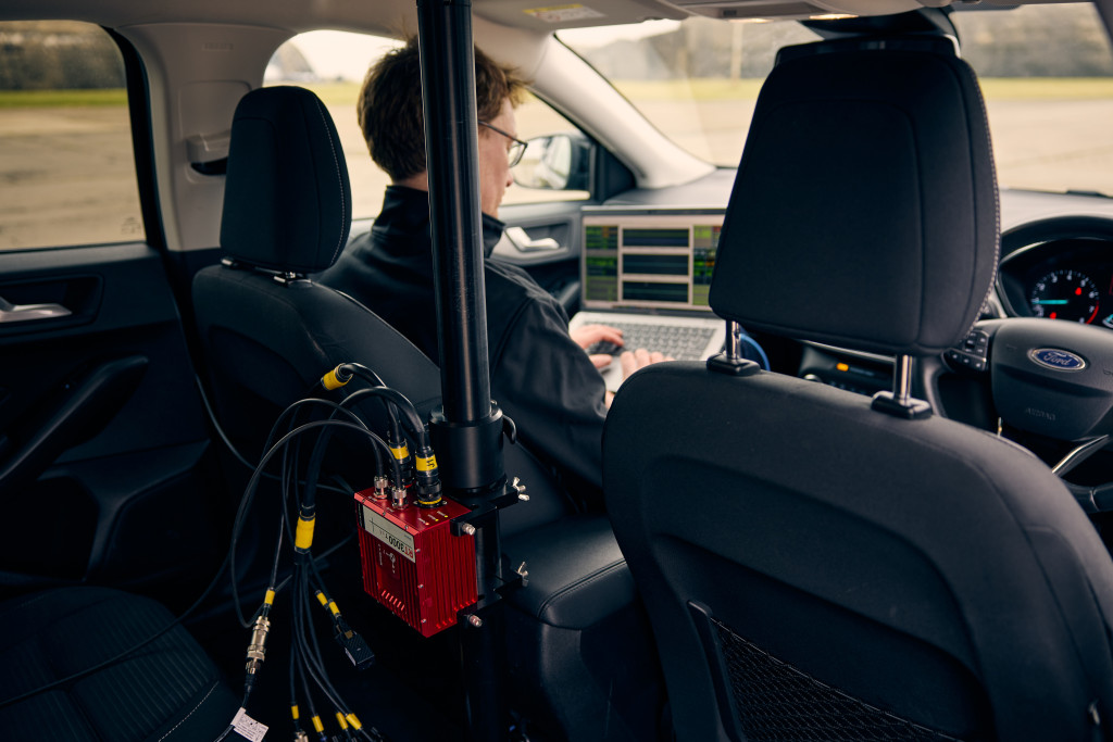
An OXTS INS for mobile mapping has several possible integrations with other sensors that make the process of synchronising devices and combining data simpler for users. Notably we integrate with most major automotive LiDAR manufacturers, including Ouster (Velodyne), Hesai, and RoboSense, through our OXTS Georeferencer software. Combined with PTP synchronisation capabilities in every GNSS/INS we make, it’s quick and easy to synchronise your sensors and integrate your data.
On the subject of integration, it’s also worth coming back to the point about protecting data accuracy in challenging environments. For mobile mappers operating in urban spaces, underground, or even reconnaissance drones functioning in areas where GNSS is jammed, one option is to integrate additional sensors into the localisation stack to increase the robustness of the localisation data, a process known as sensor fusion. You could look at building your own sensor fusion engine, or – for land-based surveying – take advantage of our ready-made version, WayFinder. Simply plug it into your mobile mapping payload, initialise, and begin.

Using an OXTS INS for mobile mapping is more than just a box-ticking exercise
Hopefully this blog has shown you how high-quality localisation data can make a real difference to the quality and value of your survey data. By choosing to invest in localisation tech that offers pinpoint accuracy, solid robustness, and easy integration options, you can offer your clients better services, and operate more profitably.
Resources
We have a range of resources that can help you decide which OXTS INS for mobile mapping is right for your project.
Our UAV Mapping and Road-based Mobile Mapping solution briefs talk more about the different localisation methods available for aerial and land-based use cases and how they can be applied to mapping applications.
Alternatively, for a more detailed look at the specifications of OXTS INS devices for mobile mapping, take a look at one of the relevant datasheets below.
Road-based mobile mapping – RT3000 v4
UAV-based mobile mapping – AV200/xNAV650, xRED OEM Board-set
If you’re interested in using an OXTS INS for mobile mapping in diverse environments like urban canyons or without GNSS completely, then take a look at the WayFinder navigation system.
Download the WayFinder Datasheet
WayFinder can help you to deliver your GNSS-denied localisation project accurately, reliably and on-budget – whatever environment you’re operating in. Find out the technical specifications and more key information here.


