 Chinese
 German
 Spanish
 Japanese
 Korean

It’s one thing to talk about best practices for mobile mappers; it’s another to showcase successful companies who are using OXTS positioning technology to do incredible things. In this blog, we’re going beyond the theory to show you what can be achieved when using OXTS technology for mobile mapping. Particularly the fight against poaching in Africa.
Specifically, we’re shining a light on a startup that’s using our technology to do something completely unique, solving a problem that many thought impossible. We’re so pleased to be a part of their story, and proud to share the work they’re doing with you. They are Xeroth AI.
Who is Xeroth AI?
Xeroth was founded in 2024, and includes in its ranks wildlife biologists, radar specialists, and remote monitoring experts. Xeroth exists to revolutionise how humanity safeguards the world’s wildlife; specifically, it is investigating how to combine AI and Synthetic Aperture Radar (SAR) systems to identify and remove wire snare traps in national parks in South Africa.
What is Xeroth doing in the fight against poaching?
Xeroth is mapping the location of wire snare traps in South African wildlife parks, so that they can be removed by rangers and wildlife can be protected.
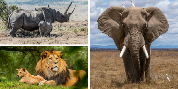
Wire snare traps are incredibly cheap to produce, easy for poachers to deploy, and difficult for rangers to spot. They are also incredibly inhumane, inflicting great suffering on the animals caught in them and decreasing the odds of survival for animals associated with the initial victim (especially the young). They are also hugely indiscriminate, threatening nearly any animal larger than a mouse, and because they are so difficult to spot, rangers can spend much of their time removing traps and still be uncertain that they have been successful in removing them all from that area. It can also be highly dangerous, for example if the animal is still alive and the rest of its family are nearby.
But the job is massive. In South Africa alone, for instance, protected areas where poachers are likely to operate amounts to around 11.3 million hectares; a massive area to cover. In addition, the difficulty with spotting wire snare traps means that rangers often only remove between 1 and 20% of existing traps, the number of which runs into the millions! To try and solve the issue another way, rangers often attempt to arrest poachers to cut off wire snares at the source. But with rangers and poachers coming from the same communities, this approach causes much conflict and tension.
Xeroth’s goal is to accurately map the positions of wire snare traps from the air. With this data, rangers can remove the traps far faster than they can at present and with far greater confidence that they have found all the traps in an area. This keeps poaching to a minimum without bringing unnecessary tensions into the local community – and, of course, it keeps wildlife from suffering an agonising death at the hands of the traps.
The solution comprises three distinct parts:
- The snareSAR, Xeroth’s bespoke SAR gathering data in the wild
- The GNSS/INS, providing accurate timing and position data to georeference the SAR data
- The AI model that analyses the data to identify wire snare traps
Xeroth has been using the xNAV650 from OXTS as its GNSS/INS.
How the solution works
In the wild, the solution works in the following way:
- The survey payload is flown over a wide area, covering around 60 km2/h. snareSAR scans the ground, and is able to penetrate through bush and tree canopies. The xNAV650 gathers position data, accurate to 2 cm, and acts as the master clock for the system, ensuring all the data is synchronised to a high degree of precision.
- After the mission, the data from snareSAR is georeferenced using the position data from the xNAV650, giving everything the radar picks up a precise position on the earth.
- The georeferenced data is then processed by Xeroth’s unique AI model, which identifies the wire snare traps in the radar data.
Xeroth’s AI model is the truly ground-breaking part of the solution. The design of the wire snare traps means that they show up well in the snareSAR data – but the data is impossible for a human to interpret.
Xeroth’s AI is a physics-informed neural network, or PINN, that sifts through the data from the SAR to identify the wire snare traps based on changes in polarisation state of the radar wave across four channels.
Even more incredibly, Xeroth’s PINN doesn’t just learn what a wire snare looks like in radar data; it learns why the wire snare looks that way, based on electromagnetic theory, so that it can detect wire snares accurately in a range of environments and conditions, without the need for large volumes of training data.
At present, Xeroth’s focus is on training the AI model to recognise wire snare traps with ever-increasing confidence, and to rigorously test the solution to prove its efficacy.
How OXTS is supporting Xeroth
Xeroth is using the xNAV650 in its work. The GNSS/INS is used in two areas: gathering real-world data (timing and position) during missions, and also for training the AI model.
Training the AI model
To train its AI, Xeroth places wire snare traps in an area and surveys their position to a high degree of accuracy. The snareSAR data is then gathered and georeferenced, and the AI is told exactly where the wire snares are in the data. This enables the AI to study those areas and learn what the profile of a wire snare is.
This process relies on the initial survey of the wire snare being as accurate as possible. If the AI is told that the snare is in a location that’s incorrect, then the profile of a wire snare that it learns will be incorrect, and its ability to identify wire snare traps in the wild will be compromised.
We’re proud to say that the Xeroth team are very pleased with the performance of the xNAV650 for training their model. Thanks to its centimetre-level precision, The AI algorithm Xeroth has created is able to reliably identify wire snare traps in the test environment.

Gathering real-world data
The xNAV650 is mounted alongside snareSAR in Xeroth’s survey payload during survey missions. They chose the device for its precision and accuracy, as well as its small form factor – the payload will be mounted to a small single prop plane for missions. Xeroth has also used our NAVsolve CMD software to integrate post-processing capabilities into their toolset. This enables the team to run PPK corrections on their survey data to improve its accuracy, without having to switch applications.
The xNAV650’s ability to act as a master clock for the system is also vital to snareSAR’s success, as it ensures that the final output can be processed and interpreted by the PINN. “Without it, the system would produce data that no amount of processing could recover,” says Graham Wallington, CEO of Xeroth.
When the OXTS data is combined with snareSAR and images from a high-resolution camera, Xeroth is able to rapidly scan an area at four different altitudes to create a tomographic synthetic aperture radar product, or TOMOSAR. This data gives Xeroth a 3D model of an area, with the wire snares accurately identified, which can be exported to tools such as Earthranger that rangers on the ground use to navigate through conservation areas and find the wire snare traps.
Better still, once a wire snare trap is identified, the rangers can log its location. That data is passed back to Xeroth’s AI model to further train it.
Looking to the future
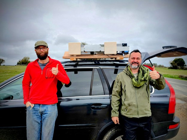
The Xeroth team recently ran a real-world test of snareSAR in the Cotswolds from the back of a car. The system, including the OXTS xNAV650, passed its field acceptance test and is now on its way to South Africa to begin field operational trials in the Greater Kruger area. It’s one of the worst affected areas in the world for wire snare poaching – and the goal is to make maximum impact as quickly as possible.
“Ultimately, if we can get this right then we can protect an enormous amount of animals from an incredibly inhumane method of poaching,” says Graham. “On top of that, by targeting the snares rather than the poachers, the rangers can spend less of their time battling against poachers and risking community divisions, and more time looking after the wildlife they are there to manage. We’re glad to have OXTS with us as a partner on this journey – together, we will create real and far-reaching change.”
We will be following Xeroth’s story closely as it develops; subscribe to our blog to see how this revolutionary mission unfolds.


